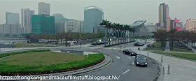
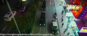
The final location from this film is the Macau Science Centre, where the tech heist is supposed to take place. At least it is the exterior part of the building that scene on screen, I doubt very much the actual heist was filmed inside.
General
▼
Bruce Lee self-guided Tours (work in progress)
▼
Thursday, August 29, 2019
Wednesday, August 28, 2019
Now You See Me 2 - Mark Ruffalo (2016) - Rua da Tercena, Macau
With a heist to pull off and limited resources, the group head off to the world's oldest magic shop run by Jay Chou and his mum, Tsai Chin. Tong's Magic Shop. The exterior for the shop is on Rua da Tercena and in real life (at least according to whenever Google was mapping the place) is a shop called "Movies Usados Son kei" i.e. the Sun Gei used movie store (note to self to check it out next time I am there).
The sequence starts off with the four walking down Rua dos Ervanarios into the small square (for want of a better word) where it joins with Rua da Tercena - the location of the shop exterior.
Tuesday, August 27, 2019
Now You See Me 2 - Mark Ruffalo (2016) - Sands Casino Hotel, Macau
I haven't looked at who helped finance this film but I will make a guess that Sands put up some big dollar to get featured so prominently in the film. The Sands is supposedly where Daniel Radcliffe's elusive character has been holed up for a considerable amount of time whilst he pretended to be dead. It's here (actually, judging by the surroundings, a studio copy) where the Four Horseman are coerced into a robbery and also in the casino hall where some of their plan starts to take shape. It's also from atop of this building that Radcliffe's character is able to keep an eye on them to make sure they have succeeded in their caper.
Monday, August 26, 2019
Now You See Me 2 - Mark Ruffalo (2016) - Avenida Sir Anders Ljungstedt, Macau
The four protagonists are taken to meet their kidnapper in the form of Daniel Radcliffe sporting a very dodgy beard. He intends to coerce them into stealing a piece of tech from a nearby expo. The route they take in the car to get to the meeting with him goes via Avenida Sir Anders Ljungstedt. The road is named after Sweden's very first Consul to China and wikipedia has a little bit more information about him.
Sunday, August 25, 2019
Now You See Me 2 - Mark Ruffalo (2016) - Rua da Felicidade, Macau
Back to the near present for the next movie and the follow up to the 2013 Now You See Me. This one starts off in the US but then "magically" moves to Macau as the "Four Horseman" are somehow flown several thousand miles across the earth whilst making their escape down an industrial waste chute.
The initial location where they first realise they are in Macau was filmed on the Rua da Felicidade, a street famous for its past as a one strip red light area. The actual shopfront where they pop out onto the street is at the very bottom (i.e.the western end) where the older 1-storey buildings end. If you look on GoogleEarth, you can see the yellow painted facade building is the place. It is part of a larger (but still old) block at the end of the street adjacent to the Fat Siu Lau restaurant.
The Night My Number Came Up - Michael Redgrave (1955) - Flying Over Cheung Chau
A quick last post from this film and it is a brief shot of the plane as it leaves for its journey to Japan and is flying over Cheung Chau - in the complete opposite to where it should be going! The land mass in the distance is the Chi Ma Wan peninsula of south Lantau island. Cheung Chau's busy bay can be seen lower right.
Friday, August 23, 2019
The Night My Number Came Up - Michael Redgrave (1955) - Kai Tak Airport - Part 3
This is the scene where the aeroplane makes its approach into Kai Tak along the Kowloon foothills and lands at runway 13. Even before Kai Tak was closed back in 1998, this approach was already impossible because most of the area over which the plane flies was redeveloped after the new runway opened in the late 1950's. I encourage you to go back and watch the clip posted earlier because the screen captures below really don't do the sequence any justice at all.
These first few images below show the plane flying past Beacon Hill in the background of image one. The exact location of the plane is over where the Lung Cheung Road was built near to where Beacon Hill Road reaches it by Beverly Heights and Elizabethan Court. The last image is around (and this is approximate) where today's Lion Rock Tunnel Road heads into the hillside.
The next set of screen capture reveals the location of the camera because the sandy path of ground in the lower part of the screen is the north end of what became known as Checkerboard Hill. The cluster of houses as the camera pans right is the Diamond Hill area. This was still a large squatter area at the time but of course is now full of high rise residential buildings. The creation of the new runway would shift the airport approach to the south side of Checkerboard Hill. The flat area in the foreground became Morse park.
Finally we get an on-board view of the landing at runway 13, you can see the runway number painted on the ground in the top two images. In the second and third images below you can vaguely make out some building on the left (north) of the runway. These should be the buildings that formed part of RAF Kai Tak. Incidentally, for a modern day comparison, this runway - or at least the first 350metres or so - was eventually turned into Tseuk Luk Street. If you look at the extreme bottom of the first image (apologies for the watermark) you can just make out the area where the road (now Choi Hung Road) crossed the end of the runway. At some point the runway was extended across the road and barriers had to be set up to prevent cars crossing as a plane was approaching.
A final quick glimpse of the plane as it completes its landing and comes to a stop with Lion Rock very obvious in the background.
Thursday, August 22, 2019
The Night My Number Came Up - Michael Redgrave (1955) - View towards Lantau Island
There are a couple of brief shots that show the plane both (supposedly) approaching and departing from the airport over a stretch of sea with some islands in the background. In actual fact these very brief shots were filmed most likely from a boat that was positioned somewhere off the western coast of Hong Kong Island.
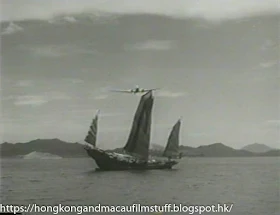
The shot with the junk below shows the approach shot, with the plane flying 'towards' the airport. You can see Castle Peak on the far right in the distance poking up between the gap that is Penny's Bay i.e. we are looking towards Lantau Island from the south east - definitely not the approach to a landing at Kai Tak by any stretch of the imagination.
The second image shows the plane 'leaving' the airport, commencing its journey to Japan, and shows roughly the same area as the first image but by now the camera has moved to the north slightly and now Castle Peak can be seen distant centre left. The light coloured patch further left is the outline of Kau Yi Chau island.
The reason I think this was shot from a boat is because there is no land in this vicinity (with this angle of view) on which the camera could be set. This also explains why the view has shifted somewhat between the two takes due to the boat drifting.
Incidentally, there is another over water shot of the plane flying across the harbour with the Kowloon hills in the distance. This most definitely could be the approach to Kai Tak but in the film, as you will see from the next post, the plane approaches the number 13 runway from the west which means it would have had to fly past the airport and then do a 180 degree turn to line up for that approach.
Wednesday, August 21, 2019
The Night My Number Came Up - Michael Redgrave (1955) - Kai Tak Airport - Part 2
A few of the buildings at the old Kai Tak can be seen on film including the old control tower (Gwulo.com has a colour picture of it supposedly from the same year which makes me think this film was most likely shot earlier) and at least one of the buildings that formed RAF Kai Tak.
Note the runway map in the background of this last picture. This is a true reflection of the layout at the time and a more detailed version can be seen here. Make a note of runway 13/31 (running NW/SE) because it will crop up in a later post.
Control Tower
If you look closely at the image below you can see two buildings in the far distance and I believe that the one centre left is the RAF Officer's Mess that now hosts the visual arts department of the Baptist University. There appears to be another similar building lower on to the left of that one. Given the angle it is also possible that the lower building is the still-existing RAF HQ Building which now houses a family crisis support centre. But it could also easily be a building that has since been demolished to make way for various housing estates.
What about the white building in the foreground? It's used as the terminal building in the film and I wonder if it was the so-called Sea Wall terminal building that was in use at the time the film was made. It could easily be one of the other older (and unused) buildings that stood along the sea front next to the 07/25 runway. If there are any Kai Tak aficionados reading this then please feel free to add any corrections.
What about the white building in the foreground? It's used as the terminal building in the film and I wonder if it was the so-called Sea Wall terminal building that was in use at the time the film was made. It could easily be one of the other older (and unused) buildings that stood along the sea front next to the 07/25 runway. If there are any Kai Tak aficionados reading this then please feel free to add any corrections.
Note the runway map in the background of this last picture. This is a true reflection of the layout at the time and a more detailed version can be seen here. Make a note of runway 13/31 (running NW/SE) because it will crop up in a later post.
Tuesday, August 20, 2019
The Night My Number Came Up - Michael Redgrave (1955) - Kai Tak Airport - Part 1
I first became aware of this film thanks to an article in the SCMP written by Adam Nebbs for his travel column. You can still see the piece here, and it explains the film better than I could - plus it has a link to the digitally restored film clip that shows the plane landing at the old airport. I did manage to find a copy but it was an inferior quality version that looks to have been recorded from the TCM channel and then transferred to DVD. Never mind, the quality is good enough for the purposes of identifying most of the locations.
It seems that 1955 was a busy year for foreign film makers in Hong Kong because this is now the fourth film I have been made aware of that was shot around that time, the others being Soldier of Fortune (actually shot at the tail-end of 1954), Flight to Hong Kong and Love is a Many-Splendored Thing.
Much of the Hong Kong location shots are actually just the old airport, however, it was filmed from various angles and I have decided to split those ones into separate parts starting with this view from the north west. The runways occupied the San Po Kong area (that was eventually turned into a factory estate). The flat area in the lower part of the image with a curved lane running alongside it shows what is now Morse park and Fung Mo St.
Thursday, August 8, 2019
Harry's Hong Kong - David Soul (1987) - Ladder Street, Sheung Wan
In general the quality of the available online versions of Harry's Hong Kong is fairly low and has prevented me from really getting into the details of various street-level locations, but here is one that many people should recognise. It's the section of Hollywood Road where Ladder Street crosses on its way up to the mid-levels. You can't see the Man Mo Temple, but the corner building antique emporium (Yue Po Chai Curios Store) doesn't appear to have changed very much over the past 30+ years. The building it is in is the Tai Hing Building. This was the replacement to the older tenement building that featured (as an exterior only) as the Nam Kwok Hotel in The World of Suzie Wong. That older building was replaced by this one in 1967, so this "newer" one is already more than 50 years old. It's sobering to know that Nancy Kwan, who celebrated her 21st birthday whilst filming that movie, turned 80 this year!
Anyway, I think that's about the lot from Harry's Hong Kong. Time for another quick break before tackling the next movie.
Anyway, I think that's about the lot from Harry's Hong Kong. Time for another quick break before tackling the next movie.
Wednesday, August 7, 2019
Harry's Hong Kong - David Soul (1987) - The Peak, Hong Kong
Harry goes up to the peak to meet his journalist girlfriend, so we get some shots of the tram before the pair head over to the Lion's Club Pavilion.


