
Showing posts with label Austin Road. Show all posts
Showing posts with label Austin Road. Show all posts
Monday, October 6, 2025
The Merry Wife - Li Ching (1971) - Austin Road, Tsim Sha Tsui
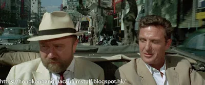
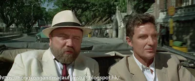
The next street we see them riding along is Austin Road, just down from the Kowloon Bowling Club which can be seen on the right of the screen next to the tree.


Sunday, January 26, 2025
The Head Hunter - Chow Yun Fat (1982) - Former Austin Hotel
Another of Yuen's hits is on a guy staying at, what was, the Austin Hotel. Unfortunately, the building has long gone and been replaced by the Surson Commercial Building at 140 Austin Road. As the police and reporters turn up we can see a couple of familiar landmarks including the former curved facade of 148 Austin Road, as well as the Kowloon Bowling Green Club on the other side of the road. I'm not sure when the hotel was demolished, but its replacement mentioned above was opened in 1993, so it wouldn't surprise me if the hotel building was still around circa 1990.

This is the alley between the hotel and
neighbouring Golden Gate Commercial Bldg


Kowloon Bowling Green Club on the right

This is the alley between the hotel and
neighbouring Golden Gate Commercial Bldg


Former 148 Austin Road in the background (now demolished sadly)

Kowloon Bowling Green Club on the right
Wednesday, October 5, 2022
Blade in Hong Kong - Terry Lester (1985) - London Theatre, Austin Road
Next up is a shot of the London Theatre (倫敦大戲院) that used to stand on the northwest corner of the junction between Austin and Nathan Roads. It was closed in 1988 and a newer version, the London Classic Cinema, opened a couple of years later. On the site now is a mixed mall/office complex called Chuang's London Plaza. Another example of building names paying homage to older venues on the same site. I think this may be a library shot because, as you can see, the advert on the outside is for Rocky 2 (released 1979).

Monday, June 1, 2020
Blood, Sand and Gold - Aaron Costa Ganis (2017) - Austin Road, Kowloon
Another incidental shot used to give some HK ambience to the following scenes. This one is a quick shot along the western side of Austin Road looking towards Nathan Road. The road on the left is Parkes Street with the Hong Kong School of Commerce just visible. In the distance you can see the art deco structure of the old shophouse that sits at 190 Nathan Road with its Austin Road-side balconies (I have pictures of it here and here).


Sunday, May 27, 2018
The Peking Medallion - Robert Stack (1967) - Nathan Road, Tsim Sha Tsui
After escaping the clutches of the nefarious Triad and its beautiful leader, Nancy Kwan, Stack is given a lift back to his hotel by the dodgy police chief he has befriended. What follows is a brief sequence shot from a car as it travels down Nathan Road at the Kwun Chung/Tsim Sha Tsui end.
The initial screen grab shows the start of the sequence just before the junction of Nathan Road with Austin Road, followed by the junction itself where you can see the "National Radios" sign on the corner building.


Next up are some of the famous Nathan Road banyan trees as we move further south, followed by the junction with Hillwood Road. The shophouses with their pavement columns have long since gone but the white building on the corner below is still around. It's the A. Kun Lok Building. It's nice a shiny here because it was brand new in 1966. These days it has changed a bit but is still recognisable.

Next up you can just make out the old wall of St Andrew's Church. This has now been assigned to history itself because the church knocked it down to building a new auditorium called the Life Centre. There was a significant amount of opposition given the age of the wall and the fact that it was a bit more picturesque than the big ugly thing that has replaced it, but there you have HK in a nutshell. On a plus point the church did retain the old entrance archway.

And the greatest irony of all is the fact that all this went on right next door to the so-called Antiquities and Monuments Office - located in the former Kowloon British School building. Built in 1902, you can see its arches in the last picture below.

The initial screen grab shows the start of the sequence just before the junction of Nathan Road with Austin Road, followed by the junction itself where you can see the "National Radios" sign on the corner building.


Next up are some of the famous Nathan Road banyan trees as we move further south, followed by the junction with Hillwood Road. The shophouses with their pavement columns have long since gone but the white building on the corner below is still around. It's the A. Kun Lok Building. It's nice a shiny here because it was brand new in 1966. These days it has changed a bit but is still recognisable.


Next up you can just make out the old wall of St Andrew's Church. This has now been assigned to history itself because the church knocked it down to building a new auditorium called the Life Centre. There was a significant amount of opposition given the age of the wall and the fact that it was a bit more picturesque than the big ugly thing that has replaced it, but there you have HK in a nutshell. On a plus point the church did retain the old entrance archway.


And the greatest irony of all is the fact that all this went on right next door to the so-called Antiquities and Monuments Office - located in the former Kowloon British School building. Built in 1902, you can see its arches in the last picture below.

Monday, January 2, 2017
L'Inconnue de Hong Kong - Dalida (1963) - Pilkem Street, Kwun Chung
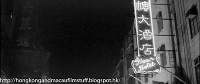
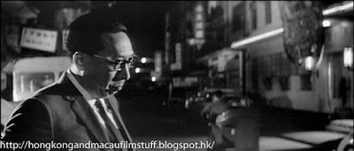
Whilst the girls are performing at the night club, they are accommodated in a hotel called the Honor Hotel. It turns out to have been a real place and was located at the Austin Road end of Pilkem Street (where the Pilkem Commercial Centre now stands). Most people call this area Jordan after the nearby MTR station, but actually it's proper name is Kwun Chung. The hotel appears to have a fair amount of sordid history according to the blurb that is attached to this video of it on Youtube.




Thursday, August 18, 2016
Cracker: White Ghost - Robbie Coltrane (1996) - Various aerial shots around Hong Kong
Finishing up Cracker: White Ghost for the time being (at least while I still grapple with some of the harder to identify locations) with this small post showing some of the location seen from the vantage point of the helicopter whilst it's trying to follow the killer.
The first shot is an aerial view of the Food and Environmental Hygiene Department HQ. At least that is the building's use now, but considering that the FEHD didn't exist in 1996 - it was created when the Urban Council was disbanded (it was the first volley in the HK Govt's war on democracy) and the councils former responsibilities were split between the FEHD and the LCSD (Leisure and Cultural Services Dept) - I am not sure what it was before hand. I'm sure some of the longer-term HK residents can provide that information. It's the low-rise building on the right. The buildings next to it are (from r to l) the Victoria Centre and the Sea View Estate.

A little further along the Hong Kong Island coastline provides us with our next bird's eye view over Quarry Bay and the two shiny buildings we can see centre screen are two of the office towers of Cityplaza in Tai Koo Shing.

We move back a bit now and over to the HK-side entrance to the Eastern Harbour Tunnel as Dennis' car heads over to Kowloon side. The shot is in B&W because we are supposedly viewing it through the camera on the chopper.

We move over to Kowloon side now and can see a rather difficult to identify junction, however as the camera pans right, following one of the taxis, it becomes obvious that we are looking at the major junction where Austin Road intersects with Chatham Road South. The giveaway is a brief view of the curved staircase outside of St Mary's Canossian College along Austin Road.


And finally we finish with a quick view over Container Terminal's 8 and 7 as the helicopter hovers above the area around Stonecutters Island. Actually, the angle here is quite low as you can see from the distant hillside buildings (in the northern Lai Chi Kok/southern Kwai Chung area) and it wouldn't surprise me to find out the camera crew had simply driven over to Stonecutters (because by then it had joined the Kowloon peninsula) and plonked the camera on one of its small hillocks.

The first shot is an aerial view of the Food and Environmental Hygiene Department HQ. At least that is the building's use now, but considering that the FEHD didn't exist in 1996 - it was created when the Urban Council was disbanded (it was the first volley in the HK Govt's war on democracy) and the councils former responsibilities were split between the FEHD and the LCSD (Leisure and Cultural Services Dept) - I am not sure what it was before hand. I'm sure some of the longer-term HK residents can provide that information. It's the low-rise building on the right. The buildings next to it are (from r to l) the Victoria Centre and the Sea View Estate.

A little further along the Hong Kong Island coastline provides us with our next bird's eye view over Quarry Bay and the two shiny buildings we can see centre screen are two of the office towers of Cityplaza in Tai Koo Shing.

We move back a bit now and over to the HK-side entrance to the Eastern Harbour Tunnel as Dennis' car heads over to Kowloon side. The shot is in B&W because we are supposedly viewing it through the camera on the chopper.

We move over to Kowloon side now and can see a rather difficult to identify junction, however as the camera pans right, following one of the taxis, it becomes obvious that we are looking at the major junction where Austin Road intersects with Chatham Road South. The giveaway is a brief view of the curved staircase outside of St Mary's Canossian College along Austin Road.


And finally we finish with a quick view over Container Terminal's 8 and 7 as the helicopter hovers above the area around Stonecutters Island. Actually, the angle here is quite low as you can see from the distant hillside buildings (in the northern Lai Chi Kok/southern Kwai Chung area) and it wouldn't surprise me to find out the camera crew had simply driven over to Stonecutters (because by then it had joined the Kowloon peninsula) and plonked the camera on one of its small hillocks.

Tuesday, June 28, 2016
Rush Hour 2 - Jackie Chan (2001) - Austin Road, Tsim Sha Tsui
The US consulate - where Zhang Ziyi places the first bomb - was actually the Tsim Sha Tsui Police station (or more correctly - the District Police HQ) on the corner of the junction of Austin Road and Nathan Road.


In the above shots, Austin Road is going from lower left to centre right and Nathan Road from centre left to bottom right. Although the building itself hasn't been altered for the film, the large hoarding that has been placed on the corner is (obviously) a fake one for the film, although the wall below it is a real wall. These days it is rather more obscured by tree growth.


In the above shots, Austin Road is going from lower left to centre right and Nathan Road from centre left to bottom right. Although the building itself hasn't been altered for the film, the large hoarding that has been placed on the corner is (obviously) a fake one for the film, although the wall below it is a real wall. These days it is rather more obscured by tree growth.
Saturday, September 5, 2015
Revenge of the Pink Panther - Peter Sellers (1978) - Un Chau Manon Godown Company, Kowloon
The finale of the film takes place in one of the dockyards that used to sit along the Yau Ma Tei/Tsim Sha Tsui harbour front. In the film it's called the Lee Kee Shipyard but in reality it was a waterfront godown area owned by the Un Chau Manon Godown Company Ltd - a real company that had ceased operations in 1976 - two years prior to filming, so I guess the area was empty and available for filming.
Unfortunately for me, this area of Kowloon has changed so significantly since filming that it is really difficult to relate film locations to current maps. However, some of the background clues (plus an old photo or two) indicate that the place was located at the western end of Austin Road just south of where a new development called "Grand Austin" is being built. The Grand Austin is being built on the site of what used to be the Canton Road Government Offices. Consisting of two blocks the former offices can be seen in the near background (behind the cylindrical storage silos) in the two pictures below. This block was the first one to be demolished when Austin Station was built and so disappeared quite some time ago. The remaining, larger, of the two blocks (it can't be seen here but would be off screen to the right, facing Canton Road) was still around until about 2011 when it was finally demolished. The following picture is embedded from Googlemaps because it looks as though Google have gone and done a sneaky thing and disabled my snipping tool for use within Maps...grrr!
Anyway, in the far background of the screencaps below you can also see the recognisable shapes of the various Man buildings of the Ferry Point Estate. These blocks are still around and because they were built in the 1960's often provide a nice reference marker for figuring out where things used to be.


Based on the angle and known position of where the Govt block used to stand, the best Streetview angle I can provide is below - it shows the southern end of Austin MTR Station which stands pretty much where the Govt block was. You can just make out the Ferry Point Estate in the distance.

Here's another shot (below) that shows the dock area from the sea looking inland. It shows the same bit of dock that Kato has just crashed off in his Dairy Farm Ice cream dispensing motorbike.

Take a good look at the background because you can just see a couple of buildings poking up behind the Un Chau Manon Godown Co Ltd. sign. Hey presto, all we need to do in Streetview is swivel to the right and you can see those buildings are still standing. The blue meshed building in front of them is the Grand Austin being erected on the site of the other Govt block.

These two buildings stand at the corner of Austin and Canton Road and are called the Wai Hang Building (built 1966) on the left and the Wai On Building (built 1962) on the right.
Our final image involves another turn to face the south, looking towards HK Island. You can see the various other dock areas that used to line the western side of the peninsula around Tsim Sha Tsui. All have been replaced by buildings such as China Hong Kong City, The Gateway etc


The view is slightly restricted in our Streetview image because there is still so much development going on in this part of Kowloon but at least you can still make out the matching ridge lines.

Unfortunately for me, this area of Kowloon has changed so significantly since filming that it is really difficult to relate film locations to current maps. However, some of the background clues (plus an old photo or two) indicate that the place was located at the western end of Austin Road just south of where a new development called "Grand Austin" is being built. The Grand Austin is being built on the site of what used to be the Canton Road Government Offices. Consisting of two blocks the former offices can be seen in the near background (behind the cylindrical storage silos) in the two pictures below. This block was the first one to be demolished when Austin Station was built and so disappeared quite some time ago. The remaining, larger, of the two blocks (it can't be seen here but would be off screen to the right, facing Canton Road) was still around until about 2011 when it was finally demolished. The following picture is embedded from Googlemaps because it looks as though Google have gone and done a sneaky thing and disabled my snipping tool for use within Maps...grrr!
Anyway, in the far background of the screencaps below you can also see the recognisable shapes of the various Man buildings of the Ferry Point Estate. These blocks are still around and because they were built in the 1960's often provide a nice reference marker for figuring out where things used to be.


Based on the angle and known position of where the Govt block used to stand, the best Streetview angle I can provide is below - it shows the southern end of Austin MTR Station which stands pretty much where the Govt block was. You can just make out the Ferry Point Estate in the distance.

Here's another shot (below) that shows the dock area from the sea looking inland. It shows the same bit of dock that Kato has just crashed off in his Dairy Farm Ice cream dispensing motorbike.

Take a good look at the background because you can just see a couple of buildings poking up behind the Un Chau Manon Godown Co Ltd. sign. Hey presto, all we need to do in Streetview is swivel to the right and you can see those buildings are still standing. The blue meshed building in front of them is the Grand Austin being erected on the site of the other Govt block.

These two buildings stand at the corner of Austin and Canton Road and are called the Wai Hang Building (built 1966) on the left and the Wai On Building (built 1962) on the right.
Our final image involves another turn to face the south, looking towards HK Island. You can see the various other dock areas that used to line the western side of the peninsula around Tsim Sha Tsui. All have been replaced by buildings such as China Hong Kong City, The Gateway etc


The view is slightly restricted in our Streetview image because there is still so much development going on in this part of Kowloon but at least you can still make out the matching ridge lines.

Thursday, October 10, 2013
I Spy (TV Series) - Robert Culp (1965) - Neon Montage, Kowloon
Okay, not my typical post here and I was struggling with what to do with it because it involves a sequence in the Carry Me Back To Old Tsing Tao episode where we have a montage of nighttime neon filling the screens, made up of multiple locations and identifiable, pretty much, only by the signs themselves. So anyway, I figured it would be fun for some if I put them all up here in one post and say where I think they are and then anyone can chip in and give me any more places they recognise.
Here's the first, which I know - courtesy of the Fourseas, Singer and Rodania signs on the right - features the junction of Nathan and Austin Roads at the northern end of Tsim Sha Tsui. But what about those other signs? Tokyo Night Bar, Tokyo Night Inn? As we locate these places I'll add them to the list of labels at the bottom.

Here is a shot of that part of Nathan Road from the 1960's showing the same signs, but in daylight (Courtesy of the excellent book 香港走過的街道). Incidentally, the building that now occupies the site on the right is still called the Fourseas building and it sits between Austin Road and Tak Shing Street.

Then we appear to move down the road (past the Singer sign) and can see the Pink Lady Bar. I believe the Pink Lady Bar was located on Hankow Road further to the south.

Pink Lady Bar also reveals Dawson & Co behind it and well as Y.K Ma Furniture and Antiques. Can you spot anymore? Where was (and what was) Dawson & Co? Perhaps it was the same tailors that can still be found in HK, if so, where were they located in 1965? Y.K Ma on the other hand seems to be a famous name in the antique business and I found a reference that calls him legendary here. Sadly, my knowledge of this are is non-existent, so if there are any informed antique people out there who know where Y.K Ma's business was based in 1965, please leave a comment.

So what else do we have? Another junction - but this time I'm not sure it's the Nathan/Austin one, perhaps Nathan/Jordan Rd? Anyway, it has the HK Silk Centre along there as well as some signs I can't read.

And then that scene merges with one a bit easier to identify...the Tai Pak Seafood floating restaurant. If you want to read some interesting details of the Tai Pak then go to the comments section of this post I did a few years ago. But this version is unquestionably the one at Aberdeen.

Next up, we have the Kobe Bar, Cherry Bar. After covering Gambit on this blog, I now know that they were actually right next to each other. For proof you can checkout this Gambit post. There also looks to be the (rather dim by comparison) sign for Mandarin Garments at the top right. I've found references to a Mandarin Garments Factory, but this wasn't registered until 1969, several years after this episode was filmed. So where was this one, perhaps Cameron Road as well?

Last but not least we have the final two images showing the New Savoy Bar and the Oriental Pearl Night Club and Bar. Now I have found a reference to both the Savoy Bar (on Granville Road) and the New Savoy Plaza (on Prat Avenue), but no reference to the New Savoy Bar. So information welcome. As for the Oriental Pearl Night Club and Bar - well, the companies register has notes to this place opening in 1964 and closing in 1969, but not mention of the location. However, I was lucky enough to stumble across this photo which shows it next to Rikki's Bar, the latter I believe was located on corner of Cameron and Carnarvon Roads. So it looks like it was on Cameron Road.

Anyway, please feel free to leave comments with regards to the locations, or perhaps even some vague reminiscences of drunken nights spent at these places :-)
Here's the first, which I know - courtesy of the Fourseas, Singer and Rodania signs on the right - features the junction of Nathan and Austin Roads at the northern end of Tsim Sha Tsui. But what about those other signs? Tokyo Night Bar, Tokyo Night Inn? As we locate these places I'll add them to the list of labels at the bottom.


Then we appear to move down the road (past the Singer sign) and can see the Pink Lady Bar. I believe the Pink Lady Bar was located on Hankow Road further to the south.

Pink Lady Bar also reveals Dawson & Co behind it and well as Y.K Ma Furniture and Antiques. Can you spot anymore? Where was (and what was) Dawson & Co? Perhaps it was the same tailors that can still be found in HK, if so, where were they located in 1965? Y.K Ma on the other hand seems to be a famous name in the antique business and I found a reference that calls him legendary here. Sadly, my knowledge of this are is non-existent, so if there are any informed antique people out there who know where Y.K Ma's business was based in 1965, please leave a comment.

So what else do we have? Another junction - but this time I'm not sure it's the Nathan/Austin one, perhaps Nathan/Jordan Rd? Anyway, it has the HK Silk Centre along there as well as some signs I can't read.

And then that scene merges with one a bit easier to identify...the Tai Pak Seafood floating restaurant. If you want to read some interesting details of the Tai Pak then go to the comments section of this post I did a few years ago. But this version is unquestionably the one at Aberdeen.

Next up, we have the Kobe Bar, Cherry Bar. After covering Gambit on this blog, I now know that they were actually right next to each other. For proof you can checkout this Gambit post. There also looks to be the (rather dim by comparison) sign for Mandarin Garments at the top right. I've found references to a Mandarin Garments Factory, but this wasn't registered until 1969, several years after this episode was filmed. So where was this one, perhaps Cameron Road as well?

Last but not least we have the final two images showing the New Savoy Bar and the Oriental Pearl Night Club and Bar. Now I have found a reference to both the Savoy Bar (on Granville Road) and the New Savoy Plaza (on Prat Avenue), but no reference to the New Savoy Bar. So information welcome. As for the Oriental Pearl Night Club and Bar - well, the companies register has notes to this place opening in 1964 and closing in 1969, but not mention of the location. However, I was lucky enough to stumble across this photo which shows it next to Rikki's Bar, the latter I believe was located on corner of Cameron and Carnarvon Roads. So it looks like it was on Cameron Road.

Anyway, please feel free to leave comments with regards to the locations, or perhaps even some vague reminiscences of drunken nights spent at these places :-)
Subscribe to:
Posts (Atom)